To make passage safe for ships, Christina Belton ’85 sails the ocean wide, mapping the sea floor
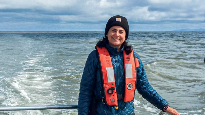
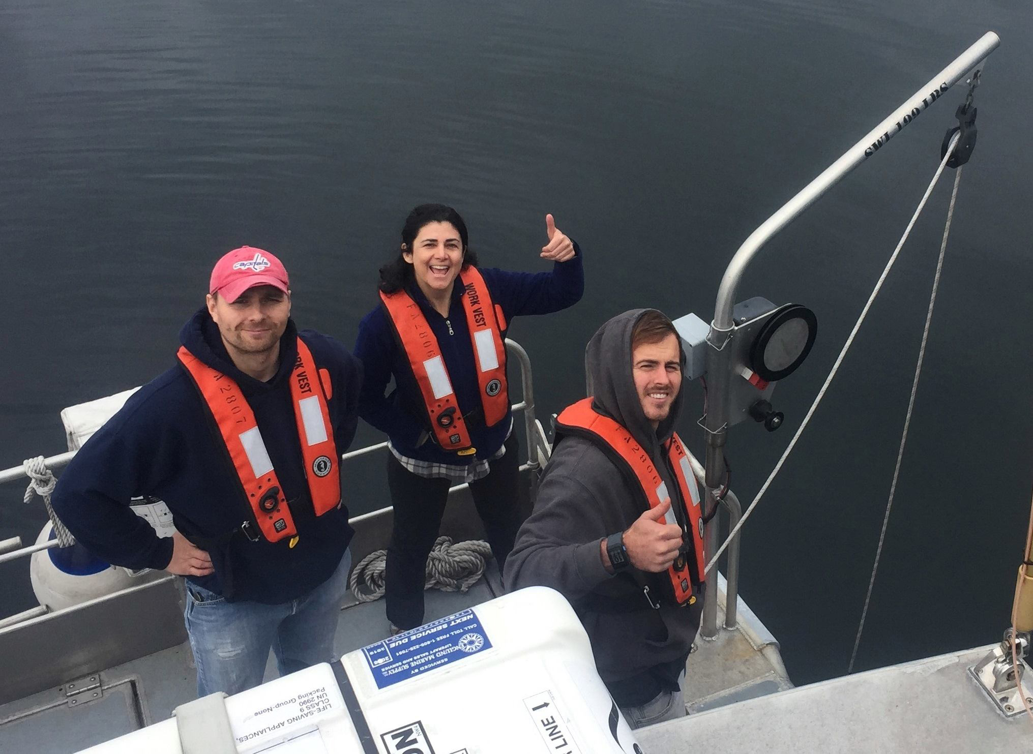
A few times a year, scientist Christina Belton ’85 heads to sea to survey our U.S. coasts. The crew’s mission on these trips is to collect data that allows them to map the plains and ridges, trenches and shipwrecks on the sea bottom and update nautical maps. The rest of the year, Belton plans hydrographic surveys from her office in Silver Spring, Maryland, at the National Oceanic and Atmospheric Administration (NOAA, pronounced like Noah).
We recently caught up with her, fresh from a trip to the Bering Sea aboard the Fairweather, a 231-foot ship that docks in Ketchikan, Alaska. She and her colleagues collected data on the sea floor that surrounds the Pribilof Islands, four volcanic islands about 300 miles west of mainland Alaska. Known for their fur seals, which were once ruthlessly exploited by colonists, the islands today are part of the Alaska Maritime National Wildlife Refuge and home to members of the Unangax people, whose ancestors hunted on the islands more than 10,000 years ago. The islands, Belton explains, provide ships with critical safe harbor during storms.
The physical sciences were not the direction Belton was headed in when she graduated as an art and art history major from Wheaton College more than 30 years ago. She’s charted her own career path, too, following her curiosity through the arts, design, technology, and science.
Your job is to map America’s sea coasts. Why are surveys so important?
I work for the Office of Coast Survey, a program of NOAA. Its primary mission is to update the nautical charts for maritime safety and services, but the data is used for other things, too, like storm surge modeling and fish habitat studies. Once our data is processed, it’s posted and publicly available. OCS has a saying: “Ping once. Use many times.”
A small team of us evaluate where we need to survey next. We look at how old the nautical charts are and how much change is happening to the sea floor because of things like hurricanes. We also consider the need. Is there more commerce? Ports all over are dredging for larger and larger vessels. This happens particularly up and down the East Coast.
The Office of Coast Survey is considered a birthplace of modern American science. It dates all the way back to Thomas Jefferson, right?
Yes, it’s the oldest scientific agency in the United States. Thomas Jefferson signed it into law in 1807. It was founded because commerce was desperate to get into ports safely. They needed charts for where the shoreline and shoals were, where the safe passages were in and out of ports. Prior to that, the shipwrecks were terrible.
How much of the world’s oceans have been mapped so far?
There are international efforts to map the entire ocean to modern standards by 2030. About 27 percent of the seas meet that criteria globally. In the U.S., it’s about 54 percent. There’s still a lot of old data out there. In Alaska, some it is from when Russia owned Alaska.
How do you figure out what lies thousands of feet below the surface?
We use echo sonar mounted on the hull of the ship to measure the depth with sound. Each ship also has smaller launch boats that we deploy to shallower areas. Zillions of points get bounced off the sea floor, and the speed with which they come back tells us how deep the water is. We capture the heights of objects down there, too—say, a rock or a shipwreck—so we can find whatever might be a danger to navigation. We also have different tools to help us account for the ship’s dynamic position.
Do you like being at sea?
I love it. It’s a required part of my job, but for me it’s a real perk—just being out on the water. I’ve been at sea as long as two months and as little as two weeks. I work with the survey team as a visiting physical scientist and, ideally, go on the survey projects that I’ve planned myself. It helps me be a better project manager and have reasonable expectations of what can get done. It feels so good to be right there to collect the raw data. It’s rare to be able to do that as a data scientist.
I’ve got to ask. Do you get seasick?
Oh, yeah, totally. A lot of people do. It’s something you have to try to manage. We talk about the weather half the time and always know what the sea is going to be doing. I have a technique for how I manage it: I always bring Diet Coke, ginger ale, carbonated waters, and lots of salty snacks.
More than 15 years ago, you made a career jump—maybe more like a leap?—from a landscape architect to a physical scientist. How did that happen?
In 2010, I was working as a landscape architect for a company that relocated me from New York to D.C., then got bought out by a bigger company. The work became less interesting. At the same time, I got really interested in GIS software—Geographic Information Systems—which urban planners use. I started taking GIS classes and was just sold on it. You can, for instance, look at land where there’s been significant climate change or deforestation or a change in resources and see how that’s going to affect its population. I attended a career fair and NOAA was there. I just really related to their mission. I took an unpaid internship for three months and found out I really loved the work. I stuck with it and the opportunities came.
Would Christina, the 16-year-old at Williston, be surprised by your life?
If someone told me, “You’re going to go to Alaska and you’re going to go many times over,” I would’ve said, “No way! That’s not my thing.” I have very warm memories of Williston. I left there feeling like I was taken care of—like I didn’t need to be scared to try new things.
Want to NOAA More?
Ocean Education Programs for Teachers and Students
Teachers at Sea: Since 1990, educators of all kinds have been working alongside NOAA scientists aboard research vessels. Participants help monitor fisheries, perform physical science studies of the ocean and climate, and map sea floors—all field experiences they can bring back to the classroom.
Internships: NOAA offers internships and volunteer opportunities to thousands of high school students, undergrads, and graduate students every year. Through the Sea Grant Student Program, it also partners with universities to offer internships and fellowships.
To learn more about Teachers at Sea and NOAA’s many student programs, see noaa.gov.
